


Artec 3D
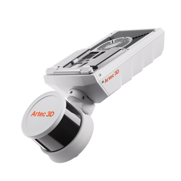
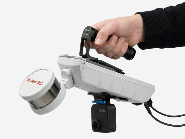
Artec Jet SLAM LiDAR 3D Scanner
High-precision mobile LiDAR mapping for any environment — indoor, outdoor, or underground.
Full specs on two pages — perfect for sharing with your team or purchasing department.
📩 Book a Free Demo / Get a Quote
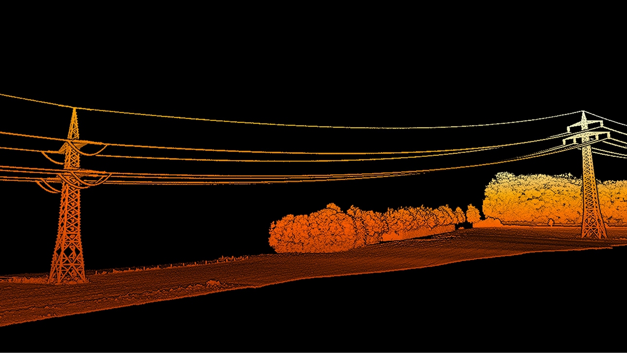
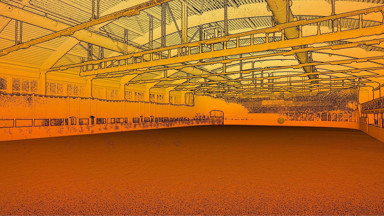
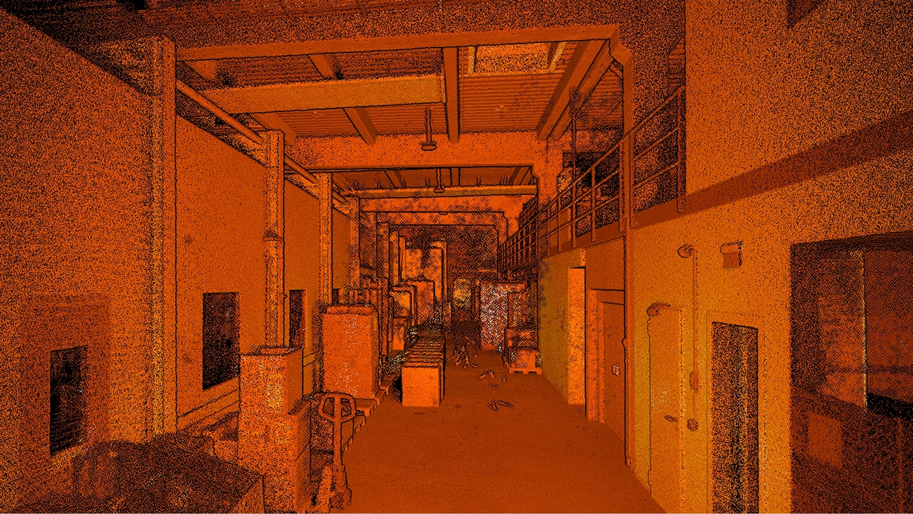
Real scenes to digital twins — in minutes
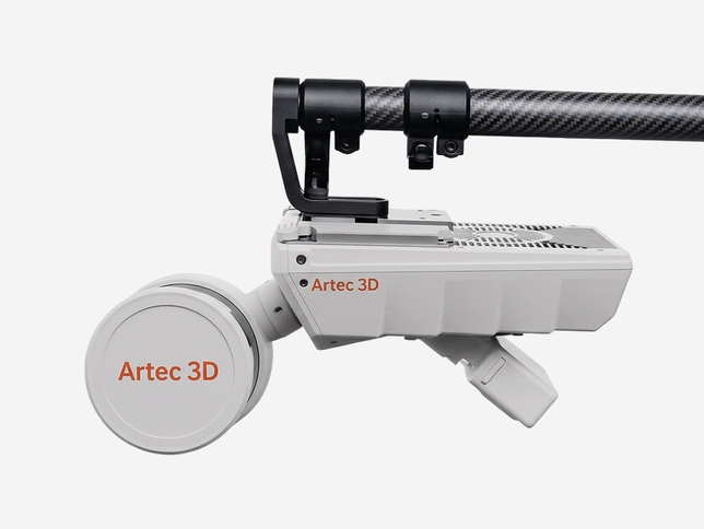
The Artec Jet is a next-generation high-speed mobile LiDAR mapping system engineered for professionals who need survey-grade accuracy without the complexity. Combining SLAM-based positioning with an AI-powered autonomy engine, it captures sites, facilities, and critical infrastructure in GPS-denied environments — in minutes rather than hours.
Whether you're doing as-built documentation on a construction site, mapping underground tunnels, scanning industrial facilities for digital twins, or performing infrastructure inspection, the Artec Jet delivers precise, reliable point clouds across environments that would defeat conventional scanners.
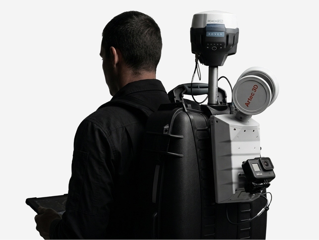
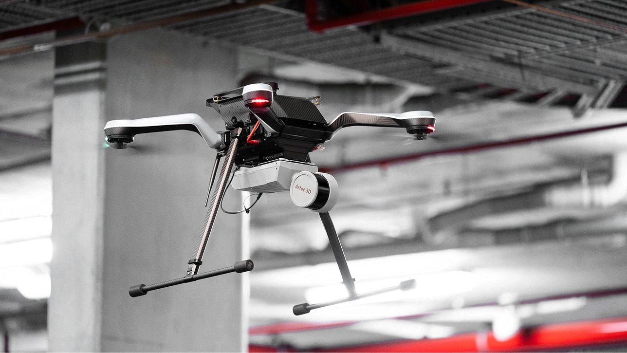
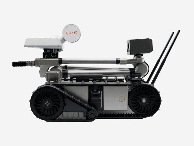
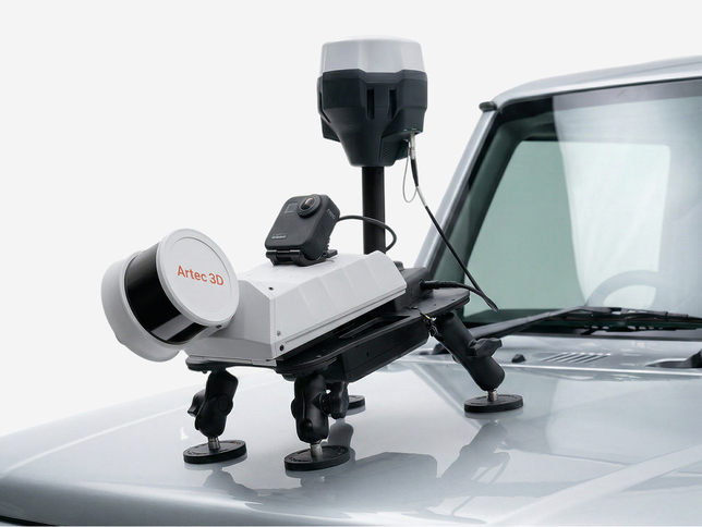
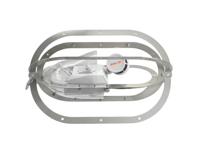
At just 1.57 kg (3.46 lb), it's compact enough to carry by hand, yet capable enough to deploy on a backpack, drone, robot, vehicle, telescopic pole, or cage — giving your team full operational flexibility with a single device.
See all 7 deployment modes →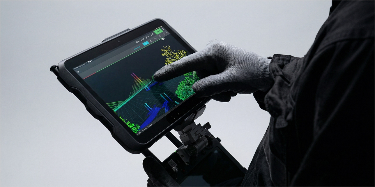
Digitize any environment — without exception
Accurate LiDAR capture in the most challenging conditions, without external infrastructure or GPS.
See the Artec Jet in action
Watch Artec's official introduction — survey-grade mobile LiDAR mapping with SLAM positioning and AI-powered autonomy, across handheld, drone, and vehicle deployments.
Engineered for confidence in every scan
Advanced features that eliminate rework, reduce on-site risk, and guarantee complete data capture every time.
Real-time scan preview
Streams a live point cloud to the companion app during scanning, confirming complete coverage before you leave the site.
360° × 290° field of view
Captures dense, shadow-free point clouds with full spherical coverage in a single pass — no repositioning needed.
GPS-free SLAM positioning
Industry-leading SLAM algorithms deliver reliable positioning underground, indoors, and in any GPS-denied environment.
Color point cloud capture
Pair with a supported camera to produce vivid, true-to-life 3D representations with immediately recognizable real-world features.
AI drone autonomy
AI-powered collision avoidance detects obstacles as small as 2 mm (0.08 in). Fly beyond line of sight into confined or hazardous spaces — hands-free.
Return-to-base failsafe
If battery runs low or conditions deteriorate, Artec Jet automatically navigates to a safe, pre-mapped return route. No drone is ever lost.
Instant proficiency
Push-button scanning and plug-and-play design means your team is capturing quality data on day one, with no specialist training required.
GNSS-assisted georeferencing
RTK accessories add satellite positioning for improved global accuracy and reduced reliance on control points in open environments.
512 GB onboard storage
Approximately 16 hours of sensor data storage onboard — no external drives, no data gaps on long missions.
One device — seven ways to deploy
The Artec Jet's robust SLAM algorithms deliver reliable results across all seven modes. One device, one workflow, one investment.
Why buy from 3DMakerWorld?
As a Gold-Certified Artec 3D Reseller, we offer more than just a transaction. You get a dedicated partner invested in the success of your scanning projects.
-
Gold-Certified Artec 3D Partner Officially authorized to sell, support, and service the complete Artec 3D scanner lineup.
-
Trained specialist team Our team holds Artec certifications and provides hands-on demos, setup, and technical onboarding.
-
Pre-sale application consultation Not sure if Artec Jet is right for your project? We'll help you determine the best fit before you buy.
-
Post-purchase support & service US-based support from people who know your exact hardware — not a generic call center.
-
Training & workflow guidance Get up to speed quickly with guided onboarding, software training, and workflow best practices.
Artec 3D Gold Reseller
3DMakerWorld holds Gold-Certified status — the highest level of Artec 3D reseller certification — reflecting our deep product expertise, sales commitment, and customer support capability.
Industries that depend on Artec Jet
From mining to civil infrastructure — deployed wherever accuracy and reliability matter most.
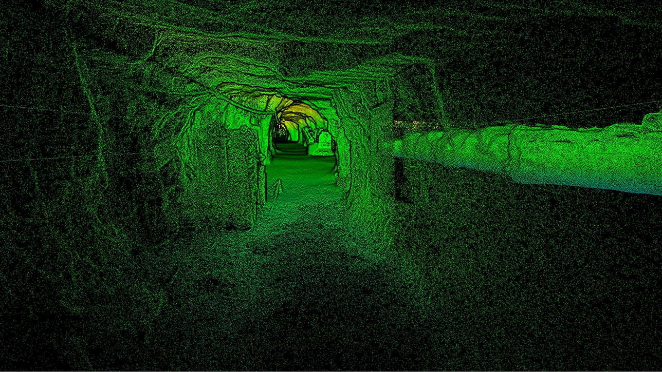
Tunnel mapping, volumetric measurement, underground asset inspection
As-built documentation, clash detection, progress monitoring
Facility mapping, crime scene documentation, hazardous area capture
Digital twins, facility layout, equipment inspection
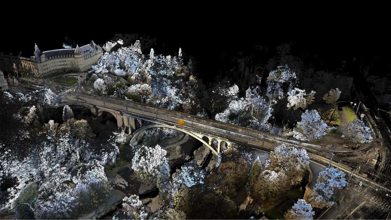
Bridge inspection, road mapping, utility corridor survey
Substation mapping, pipeline inspection, infrastructure digitization
Technical specifications
Complete Artec Jet specs for LiDAR performance, physical characteristics, and connectivity.
| Mapping accuracy (general environments) | ±15 mm (0.6 in) |
| Mapping accuracy (indoor / underground) | ±10 mm (0.4 in) |
| Change detection capability | ±5 mm (0.2 in) |
| LiDAR range | 0.5–300 m (1.6–984 ft) |
| Global accuracy with RTK | 5–10 mm (0.2–0.4 in; improved with RTK accessories) |
| Positioning method | SLAM (GPS-free) + optional GNSS RTK |
| Data acquisition (single return) | Up to 640,000 pts/s |
| Data acquisition (triple return) | Up to 1,920,000 pts/s |
| Field of view | 360° × 290° |
| Laser class | Class 1 (eye safe) |
| Minimum detectable obstacle size (drone) | 2 mm (0.08 in; wire detection) |
| Weight | 1.57 kg (3.46 lb) |
| IP rating | IP65 (dust and water resistant) |
| Operating temperature | -10°C to 45°C (14°F to 113°F) |
| Onboard storage | 512 GB (~16 hours of sensor data) |
| Deployment modes | Handheld, backpack, drone, robot, vehicle, telescopic pole, cage |
| Warranty | 2 years |
| Companion app | Real-time point cloud preview during scanning |
| Compatible software | Artec Studio 20, third-party LiDAR processing tools |
| Output formats | Point cloud (LAS, PLY, E57, and more) |
| Autonomous AI engine | Waypoint-based drone autonomy, collision avoidance |
| Return-to-base failsafe | Automatic, battery/condition triggered |
| Georeferencing | RTK GNSS accessory compatible |
Are you in Architecture, Engineering & Construction?
Download our dedicated AEC brochure for your industry.
Artec Jet vs. Matterport vs. NavVis
Three reality-capture methods, built for different jobs. Here's the short version.
Matterport
Set up, scan, and move spot to spot. The simplest, lowest-cost route to virtual tours and digital twins — but the lowest accuracy of the three.
NavVis
Mobile mapping you walk through a site. The highest accuracy of the three — but it captures from the ground only.
Artec Jet
Mobile mapping you can carry or fly — capturing ground and air in one workflow. The fastest, with full ownership of your data.
Frequently asked questions
Everything you need to know about the Artec Jet and buying from 3DMakerWorld.
The Artec Jet is a high-precision SLAM LiDAR mobile mapping system that captures detailed 3D point clouds at up to 1.9 million points per second over a 300-meter (984-foot) range. Unlike conventional LiDAR scanners, it uses SLAM-based positioning — meaning it works without GPS in underground, indoor, or other signal-denied environments. It's also unique in supporting 7 distinct deployment modes (handheld, backpack, drone, robot, vehicle, telescopic pole, cage) from a single compact, 1.57 kg (3.46 lb) device, with an AI autonomy engine for drone mapping.
Yes. The Artec Jet is specifically engineered for GPS-denied environments. Its industry-leading SLAM (Simultaneous Localization and Mapping) algorithms build a real-time map of the surrounding environment to maintain accurate positioning — no satellites needed. This makes it ideal for tunnels, mines, underground infrastructure, subterranean facilities, and dense urban canyons where GPS is unavailable or unreliable.
The Artec Jet delivers ±15 mm (0.6 in) mapping accuracy in general outdoor environments, ±10 mm (0.4 in) in indoor and underground environments, and ±5 mm (0.2 in) change detection capability. With RTK GNSS accessories, global accuracy can be further improved. These levels are appropriate for digital twins, as-built documentation, volumetric measurement, and structural inspection in construction, mining, civil infrastructure, and industrial applications.
Yes. 3DMakerWorld is an official Gold-Certified Artec 3D Reseller — the highest tier of Artec reseller authorization. This means we are fully authorized to sell, demonstrate, and support the complete Artec 3D scanner lineup including the Artec Jet. Our team holds Artec certifications, allowing us to provide expert pre-sale consultations, hands-on demos, technical onboarding, and ongoing US-based support.
The Artec Jet is widely deployed in mining (tunnel mapping, volumetric surveys), construction (as-built documentation, clash detection), defense and public safety (facility mapping, hazardous area capture), civil infrastructure (bridge and road inspection), manufacturing (digital twins, plant layout), and utilities (pipeline and substation mapping). Its GPS-free capability and rugged IP65 rating make it suitable for any challenging environment.
Yes. The Artec Jet's AI autonomy engine enables full drone-based aerial LiDAR mapping, including GPS-denied environments. You simply set waypoints; the drone flies autonomously with active collision avoidance that can detect obstacles as small as 2 mm (0.08 in) wire. A return-to-base failsafe automatically brings the drone home if battery drops or conditions change. This makes it possible to map elevated, dangerous, or hard-to-reach areas without putting personnel at risk.
The Artec Jet pairs with Artec Twins for point cloud processing, cleaning, registration, and export. It also supports third-party LiDAR processing software via standard output formats including LAS, PLY, and E57. A companion mobile app provides real-time point cloud preview during scanning for on-site verification.
Ready to see the Artec Jet in action?
Talk to a 3DMakerWorld specialist — Gold-Certified Artec 3D Reseller. Get expert advice, a personalized quote, or book a free live demo.